
Public Viewing of Drone Flight along the Merrimack River, part of MVP Action Grant supporting Resiliency Planning for River Road area
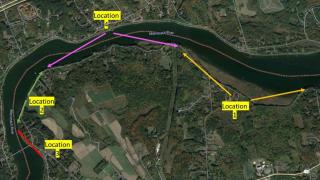
Residents are welcome to come watch the Town's consulting staff (GEI) fly a drone to capture photos and videos of the banks of the Merrimack River. The drone footage will be used to document areas of erosion and bank instability as part of the River Road Vulnerability Assessment.
To watch the flight, please park at the trailhead parking at the eastern end of River Road and follow the trail towards the Indian River. GEI staff and members of the Town's Climate Change Resiliency Committee and Town staff will be on site to discuss the drone operation. The first flight location will be from nearby the Indian River Bridge beginning around 11 am on Wednesday, December 6th. From there, GEI staff will be headed west down River Road for additional drone flight locations throughout the day.
A GEI staffer will also be on the ground evaluating culverts, outfalls, and other stormwater management systems in the area on the day of the drone flight and possibly on another day. 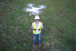
To learn more about this project, visit www.wnewbury.org/2023MVPGrant
If you have any questions or would like to learn more, email climate@wnewbury.org