Historic Sites Survey
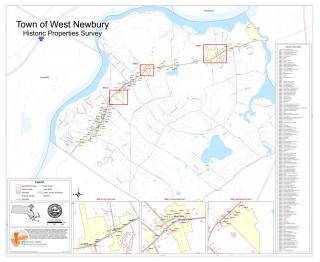
Click here for a higher resolution map of Phase 1 Historic Sites Survey areas and structures
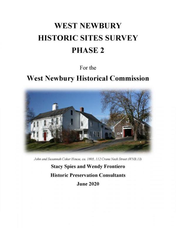
Click here for a map of Phase 2 Historic Sites Survey areas and structures
2019-2020 Historic Survey Overview
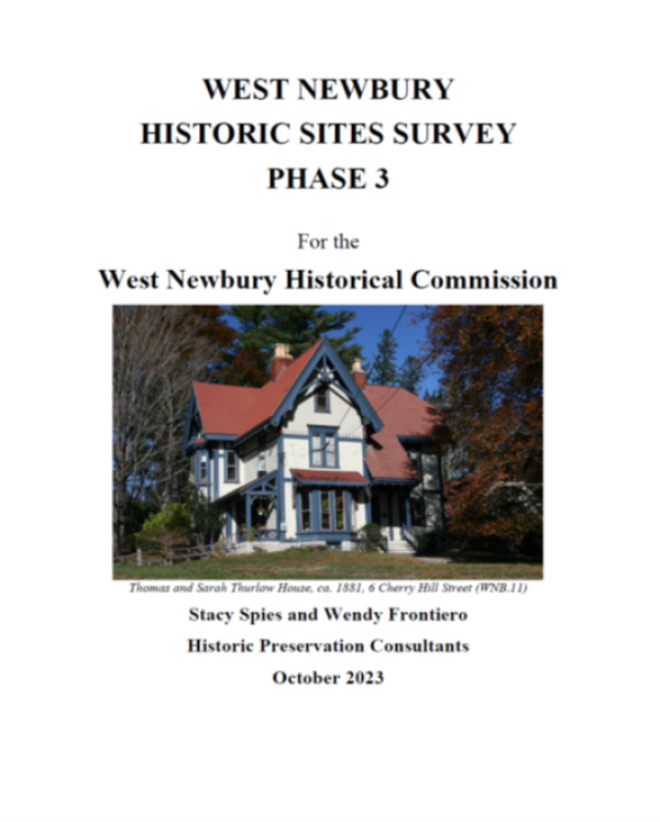
Click here for a map of Phase 3 Historic Sites Survey areas and structures
2022-2023 Historic Survey Overview
Properties Covered, By Address
Use Hyperlinks in Tables of Contents to Reach Individual Properties
Archelaus Pl #42 (Former Almshouse)
Bachelor St #25, 110-118 (Walnut Hill Cemetery), 144, 157, 169, 210
Bridge St #5, 7, 9, 53-61 (Bridge St Cemetery), 65, 67, 70, 87
Crane Neck St #4, 11, 75, 81, 84, 93, 112, 147, 155, 158, 175, 194
Garden St #2, 7,12, 21 (Laurel Grange), 28, 86, 93
Indian Hill St #13, 52, 55, 57, 66, 95, 110, 111, 128, 135, 152 (Sawyer Burial Ground), 164
Main St #66, 68, 74, 78, 84, 87
Main St #102, 118, 124, 127, 139, 154, 161, 162, 165, 169, 170, 171, 175, 178, 196, 199
Main St #300 (St. Ann's Church), 308 (2nd Congregational Church), 314, 317, 318, 319, 320, 322, 323, 325, 331, 333, 335, 337-39, 345, 347, 356, 360, 363 (Carr Post), 368. 369, 370, 374, 381 (1910 Building), 382-84, 386, 390-92, 396 See also the Manufacturers' Row Historic Area
Main St #400, 407 (Hills House Museum), 411, 412, 416, 433, 444, 464, 465, 476, 490 (G.A.R. Memorial Library), 491 (Town Hall), 495 See also the Training Field Historic District
Main St #503, 505, 510, 511, 528, 529, 546, 555, 558, 563, 591
Main St #747, 750, 760, 772, 774, 796 See also the Way to the River Historic Area
Main St #800, 801, 803, 805, 806 (Former 1st Parish Meeting House) , 810, 820, 832, 836, 841, 866 (Former Brown Spring Fam), 885 (St. John's Hall & All Saints Episcopal Church) See also the Way to the River Historic Area
Main St #901, 905, 914, 928, 961 (Former Co-operative Creamery)
Maple St #4, 8, 12, 13, 14, 18, 22, 24, 32, 38, 56, 58, 70, 78, 82, 90 See also the Maple Street Historic Area
Mechanic St #5, 7, 13, 15, 17, 19
Merrill St #3, 6, 10, 11, 12, 13, 14, 16
Pleasant St #3, 6, 8, 9, 10,16, 44-50 Merrimack Cemetery
Poorhouse Ln Almshouse Cemetery
Prospect St #7, 8, 10, 12, 14, 15, 17, 18, 19, 21, 23, 24, 25, 26, 35, 51
Training Field Rd #2, 4, 6, 8, 10 See also the Training Field Historic District
Way To The River Rd #24 See also the Way to the River Historic Area