
Historic Markers in West Newbury
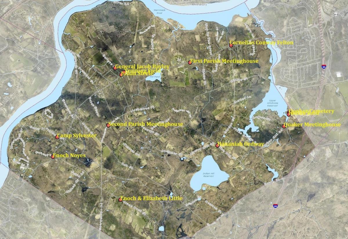 Base Map Credit: Merrimack Valley Planning Council MIMAP-- for more detailed, expandable map, click here
At the 1900 Annual Town Meeting, West Newbury's Town Improvement Society was authorized to erect historic "tablets" under the direction of Dr. Orin Warren. The Society selected the site and text of each of the signs. The white markers have been replaced—apparently unchanged in the main in content and location—several times in the intervening decades, most recently in 2003-04 by Gregory Jennell as part of an Eagle Scout project. To celebrate West Newbury's 2019 bicentennial, the Historical Commission prepared monthly tales of the stories behind the Town's historical markers.
Click on the links below for 14 more detailed stories:
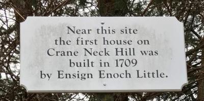
The site where Elizabeth and Enoch Little started the first homestead in the area is located at 127-57 Crane Neck Street. The story behind this marker is both a love story and a tale of an unmet governmental directive to build a wall here in West Newbury. January 2019
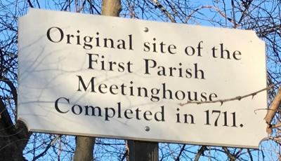
The site of the First Parish Meetinghouse is located at 708-70 Main Street. The story behind this marker is about West Newbury’s origins as a separate town, begun with a Thirty Years Quarrel that involved unauthorized construction of two rivalrous meetinghouses—three if you count the one rebuilt after the hostile razing of the first by adherents to the second. February 2019
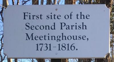
The site of the Second Parish Meetinghouse is located at 27 Meetinghouse Road. The story behind the marker is one of westward expansion, and, for the benefit of us all then and now, creation of the 1729 map showing who lived where on the roads and lanes extant at that time in West Newbury almost three centuries ago. March 2019
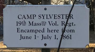
The site of Camp Sylvester, a sort of holding station for eager Civil War enlistees awaiting marching orders as the Union Army got itself organized, is located at 16 Pleasant Street. The story behind this marker is one of anxious and bored soldiers-in-waiting who came here in April, 1861 to enlist in the Union Army. Their minor rebellion finally brought them tents, some supplies, and a camp to call their own here in West Newbury. April 2019
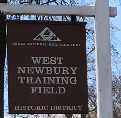
The Training Field is located at 494-506 Main Street. The Town’s first open space acquisition, this civic place is perhaps most central to West Newbury’s geography, history, and heart—where gatherings ranging from mustering of Revolutionary War minutemen to the late 19th century West Newbury Farmers’ Club extravaganzas to our current day Christmas tree lightings have occurred here in West Newbury. A slideshow of old photos and clippings about the Training Field is here. May 2019
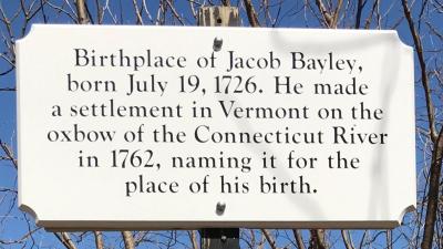
The birthplace of General Jacob Bayley is located at 11 Baileys Lane. The story behind the marker is one of a war hero and civic leader whose new Newbury, Vermont, could have ended up in New Hampshire or New York all while staying put, and who spent his first 21 years here in West Newbury, Massachusetts. June 2019
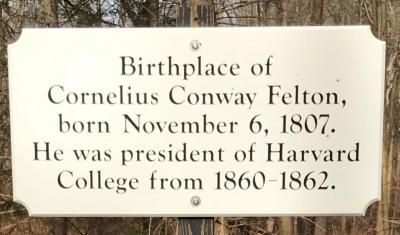
The birthplace of Cornelius Conway Felton is located at 868-98 Main Street. The story behind the marker is one of a famous classicist and educator whose “genial disposition and his fellow-feeling with young life, which never waned, made him a favorite teacher, even with those who profited the least by his instruction”—and whose remarkable West Newbury-born siblings included brother Samuel Morse Felton, who as President of the Philadelphia, Wilmington & Baltimore Railroad helped save President Lincoln and his train from being blown up in an assassination attempt. July 2019
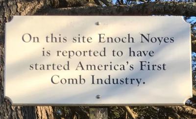
The site where Enoch Noyes started the combmaking industry in America is located at 127 Main Street. The story behind this marker involves an eccentric genius who invented not only combmaking in America, but also the exercise regimen of jogging around the countryside here in West Newbury. August 2019
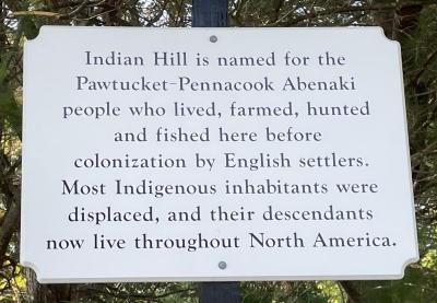
The site of the (allegedly) only killing of an Indian in all of the Newburys throughout all of the decades of Indian wars is located at 57 Indian Hill Street. The story behind this marker raises questions about the way we look back at the Indian wars and includes the tale of a New Jerseyan’s foiled plot to invade via the Indian River here in West Newbury. September 2019
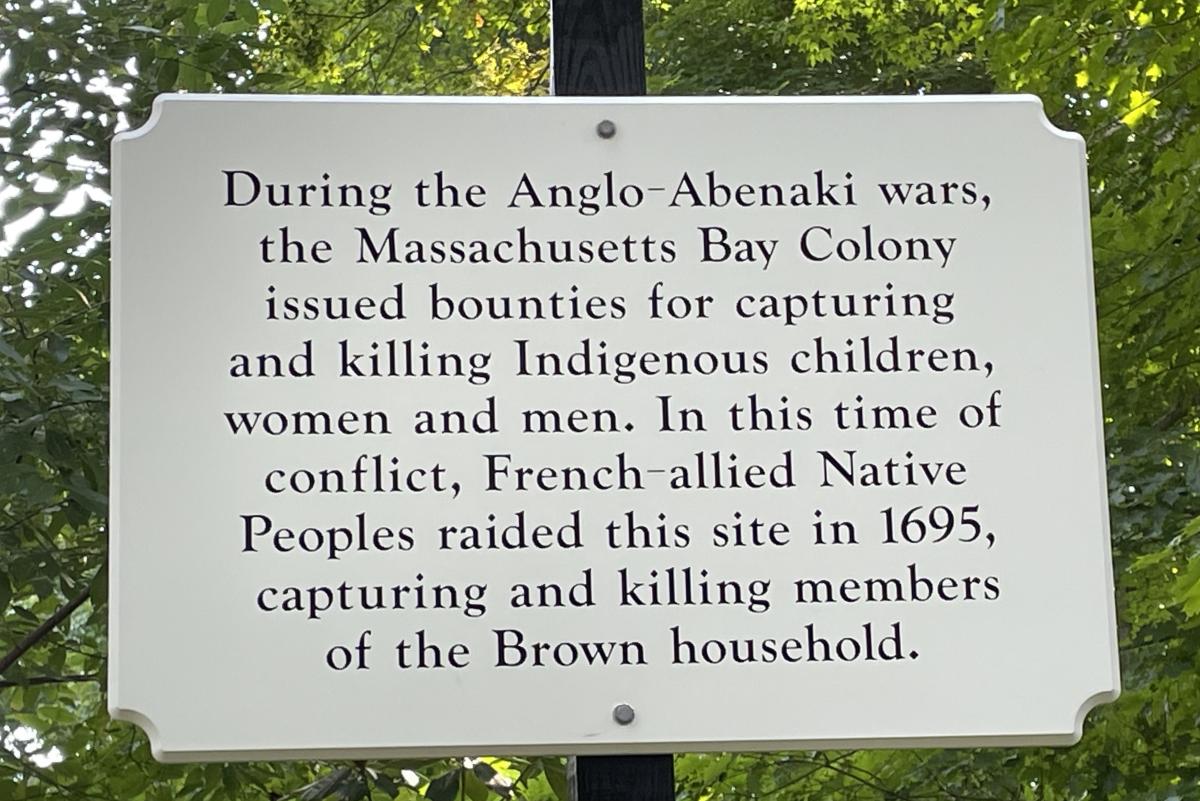
The site of a 1695 Indian raid on the Brown household is located at 127-33 Turkey Hill Road. The story behind the marker involves a war sparked by New England Governor Andros’ raid on the home of the Baron de saint Castine in Acadia, which was one of the many affronts (in addition to high taxes) that caused the colonists to fire the governor and ship him back to England in 1689. In this tale, what went around in Maine came around on Turkey Hill here in West Newbury. October 2019
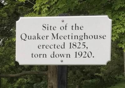
The site where the Quaker Meetinghouse stood from the 1820s to the early 1900s is located at 114 Turkey Hill Road. The story behind the marker reflects the hostility that greeted the Society of Friends in Puritan Massachusetts and specifically in our Town, where, nevertheless, they persisted. November 2019
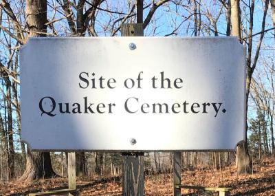
The site of the Quaker Burial Ground is located at 134-36 Turkey Hill Road. The cemetery was established in 1855 when the Society of Friends acquired about an acre of land just within the West Newbury border at Turkey Hill. The story behind the marker involves the relocation of a Quaker Cemetery to pastoral West Newbury to make way for development in Newburyport. It is also the story of dedicated volunteers, not least Susan Poore Follansbee and Gregory Jennell, who have worked to preserve and share our history here in West Newbury. December 2019. With Community Preservation Act funding, the Quaker Cemetery was again cleaned up in 2023. Click here for a list of those buried at this site.
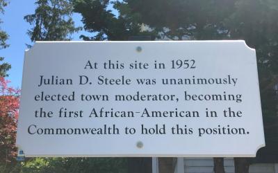
At its November 2019 Town Meeting, West Newbury voted unanimously to use Community Preservation Act funds to install a historic marker honoring Julian D. Steele—the first such white plaque in at least 50 years. The site where the Town voted to make Steele Town Moderator, the first Black person in the state to hold this position, is Old Town Hall, located at 491 Main Street. The story behind the marker is one of a civic and religious leader who championed such causes as civil rights and affordable housing and who was “[k]nown and respected in Washington, responsible and influential on Beacon Hill, [but] still reserved time for participation in local government as moderator of the town of West Newbury.” Click here to see a video recapping Julian Steele's story.
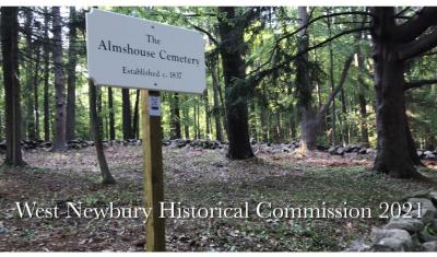
In 2021, West Newbury recognized and preserved the Almshouse Cemetery, located at the northwestern corner of the Town Forest on Poorhouse Lane. Consciously or not, almshouse graves, like the residents themselves, were perhaps designed to be forgotten. Historians explained, “The unworthy poor were institutionalized, kept literally at the margins of town society, and symbolically excluded at their death by burial in a pauper’s grave.” Construction excavators and, as in West Newbury, historians have led the way in rediscovering poorhouse graveyards, recognizing that those who died unclaimed should be remembered as part of the community. Click here for virtual gravestones for those in the Almshouse Cemetery, and click here for a video about the Town’s work to remember and preserve the burying place.